REAL-TIME MOBILE RESOURCES TRACKING
KYROS allows monitoring all our devices and mobile resources, either in real time, or historical.
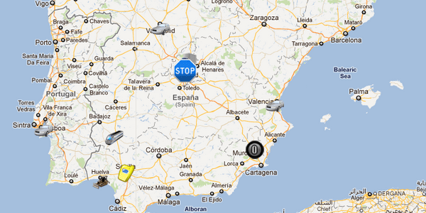
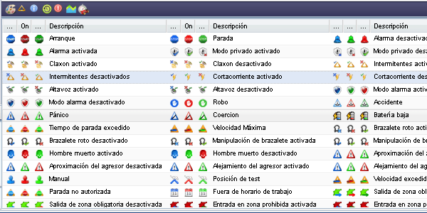
From the main window of maps in the system, we access to the most relevant information of each of the managed devices. One or more devices can be displayed on the screen with their last stored location. System refreshes automatically location of vehicles according to configuration determined. Each device can be assigned with a different icon that allows us to distinguish it from the rest clearly. KYROS also includes a code of colors in order to differentiate information about the device status at every time (blue – current location, grey – previous location, red – device with an emergency activated…). It also includes icons to show all the events KYROS can manage in order to give graphical information at a glance (stop, start, pause or standby, excess speed, entry in zone, accident….)

Figure 1: Live monitoring of companies’ on-move people, vehicles and objects or assets: Mobile Resources

Figure 2: People, Vehicles and Assets events managed by Kyros Location-based services platform
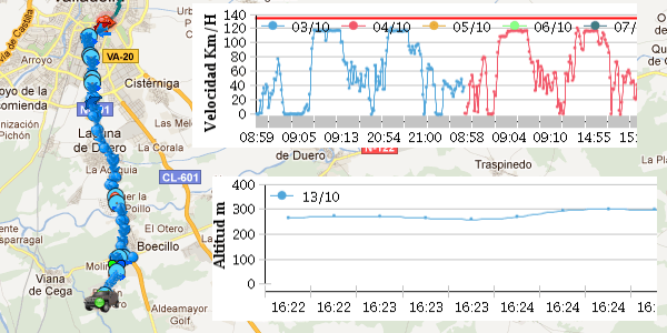
From the same window KYROS allows consulting and checking history activity routes of some devices, so we can review the itineraries achieved by the devices and compare to the deviations performed. In addition to this information, under the map area we can obtain graphical reports of the selected devices at every time (speed graphics, altitude, last received events….)

Figure 3: Vehicles travel historical data represented on live map and speed and altitude graphs.
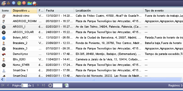
In the lower part of the map, detailed information about last sent event of each device is available. It is shown information of date, time, location and possible specific events for each device.
All this information is linked directly to the representation of device on the map, so, if we select any device from the list, the map will focus and centre showing location with a flag. At the same time, a tooltip deploys showing all information associated.
There is also an option to export information in an Excel file.

Figure 4: Kyros Minigrid describing the last event sent by mobile resources: companies’ on-move vehicles, people and assets


